Mapping Land Cover and Pollination Demand
Remote sensing products, ground information and pollination service models will be used to develop land cover maps capable of informing about the distribution of pollination demand. When coupled with functional trait and interaction network models, these maps will help us quantify the demand in pollination services across landscapes and better predict and manage stocks and benefits available. These tools will also help us identify potential mismatches between high demand and low supply of pollination services to allow targeting of interventions (mitigation & conservation).
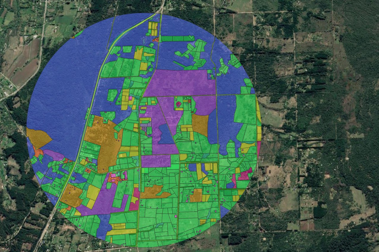
We will use Sentinel-1 and Sentinel-2 satellite imagery, machine learning techniques with ground collected training sets to develop comprehensive maps of crop distribution in Argentina Chile and Brazil. These maps will be used together with spatially explicit plant-insect interaction data and trait data to predict the functional resilience of pollination services for different crop types in different landscapes.
Complementarity and biologically diverse communities can buffer pollination services to environmental changes. Increasingly, evidence suggests that functionally diverse assemblages are essential to support resilient pollination services to crops. Identifying potential deficits at multiple scales allow targeted policy interventions aimed at enhancing ecosystem service to be developed. We will use satellite remote sensing to provide up-to-date, and cost effective landscape maps to support regional to international-scale ecological analyses of pollinator resilience for high value crops in South America.
Land Cover maps for:
- Estimating demand for insect pollination services (by mapping the amount of pollinator dependent crops present and weighting this by how dependent each crop type is on insect pollination).
- Quantifying the capacity of the land to provide pollination services (by estimating the probability that functionally important pollinators will visit crops within different areas)
- Modelling the rate at which functional diversity will collapse in response to species extinctions to provide an index of functional redundancy.
The national maps produced will provide a high value evidence base supporting policy by enabling us to explore the interactions between pollinators, crops and landscape heterogeneity. By integrating earth observation, ecosystem service models, functional ecology and pollinator population and foraging models, this work will contribute to deliver co-ordinated landscape planning and optimisation of pollination to support sustainable agriculture.